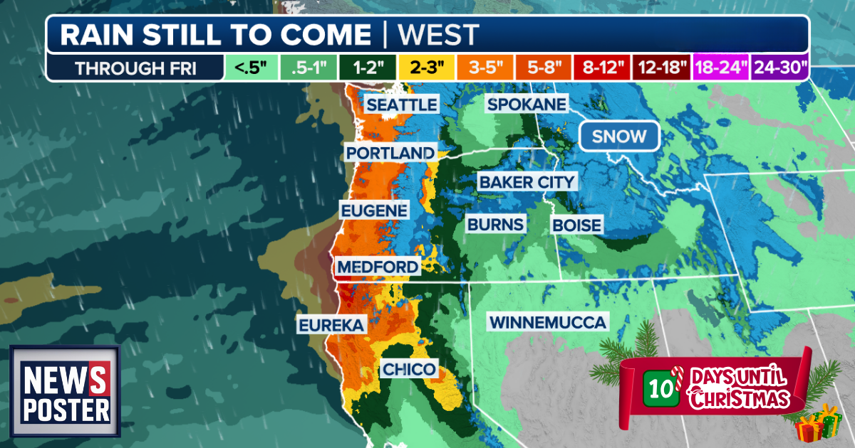
SEATTLE, WASHINGTON – Washington is preparing for additional flooding this week as a new atmospheric river moves into the region, following last week’s historic deluge. The system is expected to bring heavy rain and strong winds starting Monday and continuing through Tuesday, raising concerns about rivers already running high.
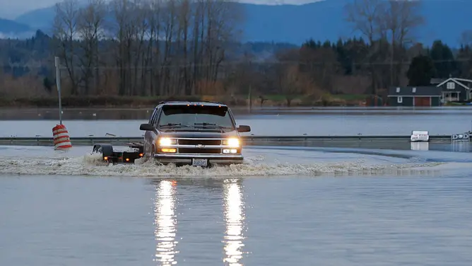
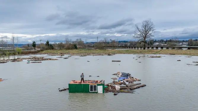
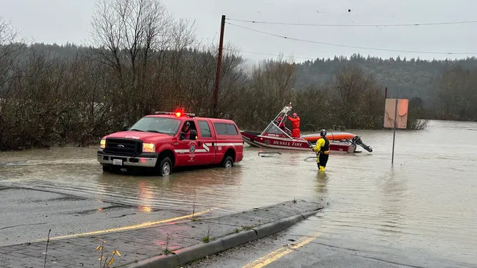
Last week’s storms dropped more than 22 inches of rain in some areas, causing dozens of rivers to reach major flood stage and prompting widespread damage to homes, roads, and infrastructure. Highway closures, evacuations, and emergency rescues were reported across the state. In Burlington, nearly 11,000 residents were evacuated as the Gages Slough River flooded into homes. The Snohomish River also reached a record 34.15 feet and is expected to rise further during this week’s storms.
Gov. Bob Ferguson described the flooding as “truly historic,” citing the Skagit and Cedar rivers as facing unprecedented water levels. Mudslides have impacted parts of the state, including a slide on US Highway 2 that could cost $7–10 million in economic losses. A state of emergency was declared on Dec. 10, and federal assistance through FEMA was authorized on Dec. 12.
The new atmospheric river is expected to deliver roughly an additional inch of rain to lowland areas, while mountain regions, including the Cascades north of King County, could see several inches. Rivers such as the Skagit and Snohomish are forecast to reach or remain near major flood stage, with the Skykomish and Snoqualmie rivers potentially entering moderate flood levels again.
A wind advisory is in effect for lowland areas through Monday, with gusts up to 40–45 mph that could bring down trees and power lines. Cooler air arriving midweek is expected to shift precipitation in higher elevations to heavy snow, while lower regions continue to experience rain. The extreme weather is likely to persist through the end of the week.