CLEVELAND, OHIO – An active December winter pattern influenced by La Niña is expected to bring another series of fast-moving snowstorms across the Northern Plains, Midwest, and Northeast through next week.
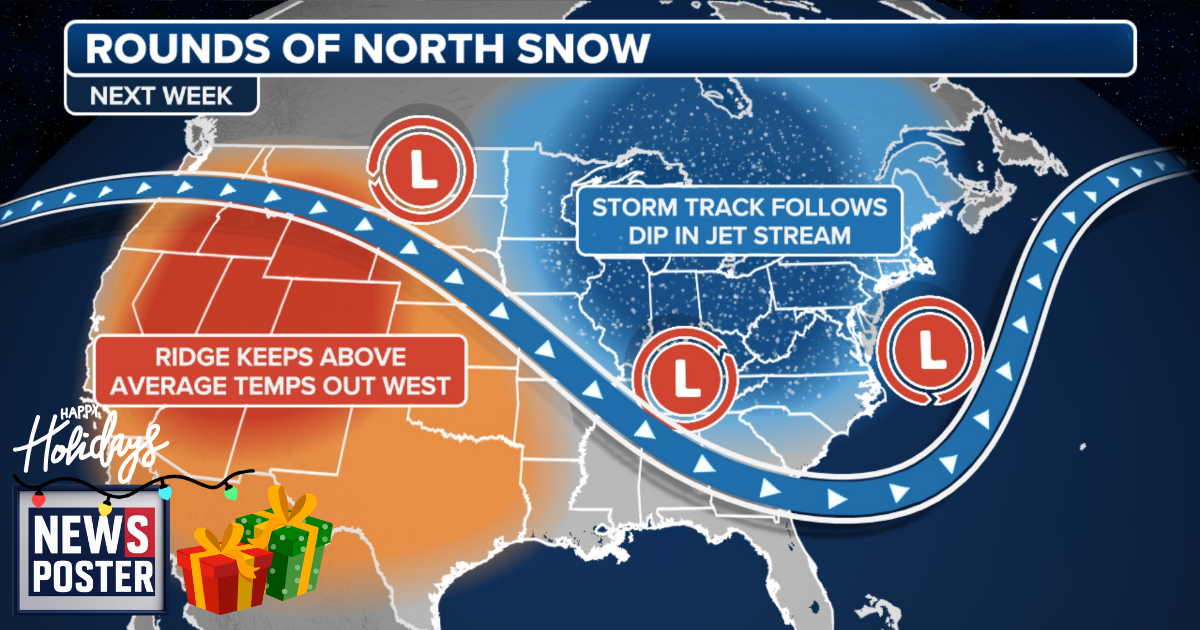
Meteorological winter, which began last Monday, has already produced a cross-country winter storm along with systems dumping feet of lake-effect snow. A strong ridge of high pressure over the Pacific Northwest is set to intensify this weekend, channeling incoming Pacific moisture over a large dip in the jet stream. This moisture will mix with Arctic air from Canada, producing several fast-moving snowstorms known as clippers.
The first clipper is forecast to move into the Northern Plains, Midwest, and Ohio Valley Saturday night, though snow totals are expected to remain modest at 1-3 inches due to the storm’s rapid movement. By Tuesday, another clipper is predicted to develop over southern Canada and track into the Upper Midwest. While its exact path and intensity remain uncertain, models indicate it will also be a fast-moving system, with the heaviest snow likely across the Great Lakes region and far northern New England.
By midweek, another surge of cold air from Canada is expected to settle across the same areas, creating favorable conditions for ski resorts. Once established, a third clipper could move through Thursday and Friday, again impacting parts of the Midwest. Cities expected to see accumulating snow next week include Minneapolis, Chicago, and Buffalo, New York, with Cleveland potentially experiencing daily snow. Residents from North Dakota through Ohio and into Maine are advised to monitor the latest forecasts.