The mid-Atlantic and Carolinas are bracing for the coldest Arctic air of the season later this week, raising concerns of icy conditions for drivers as a storm moves out of the Southeast and along the East Coast.
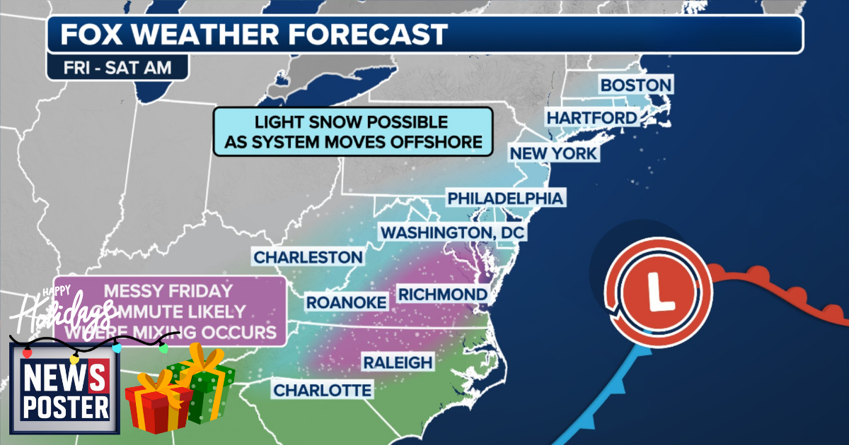
Millions of commuters along the Interstate 95 corridor in Virginia and North Carolina could face slick roads by midday Friday, potentially creating a more hazardous evening commute compared to morning conditions. Western Virginia and the mountains of western North Carolina, still recovering from the damage caused by Hurricane Helene in 2024, may also experience ice accumulation on Friday.
A broader stretch from Virginia to Massachusetts could see snow accumulations ranging from a light coating to an inch through Friday into Saturday, impacting major metro areas including Washington, D.C., Philadelphia, New York City, and Boston. Cities such as Charlotte, North Carolina, and Roanoke, Virginia, may see their first snow of the season as Arctic air pushes east across the Midwest and into the Northeast by Thursday.
A high-pressure system developing in the Northeast on Thursday will funnel the cold air south, east of the Appalachians, bringing nighttime temperatures in cities like Richmond, Virginia, and Raleigh, North Carolina, down to the upper 20s and low 30s. Meanwhile, a storm system delivering heavy rain across the Southeast is expected to ride up the East Coast and collide with the frigid air on Friday, producing potential snow and ice.
The cold air is expected to become trapped at the surface between the mountains and warmer air rising above from the storm system, a phenomenon known as cold-air damming. While forecast details on snow and ice accumulations are still evolving, travelers along Interstates 95, 91, 40, 85, and 77 should closely monitor updates.
This forecast follows a series of winter storms that have affected much of the country in early December and aligns with NOAA’s long-range outlook predicting an active start to meteorological winter, influenced by the ongoing La Niña pattern.