PORTLAND, OREGON – Residents of the Pacific Northwest prepared for another round of heavy rain on Wednesday after a powerful storm battered the region the previous day, causing rivers to swell, roads to close, and prompting multiple water rescues.
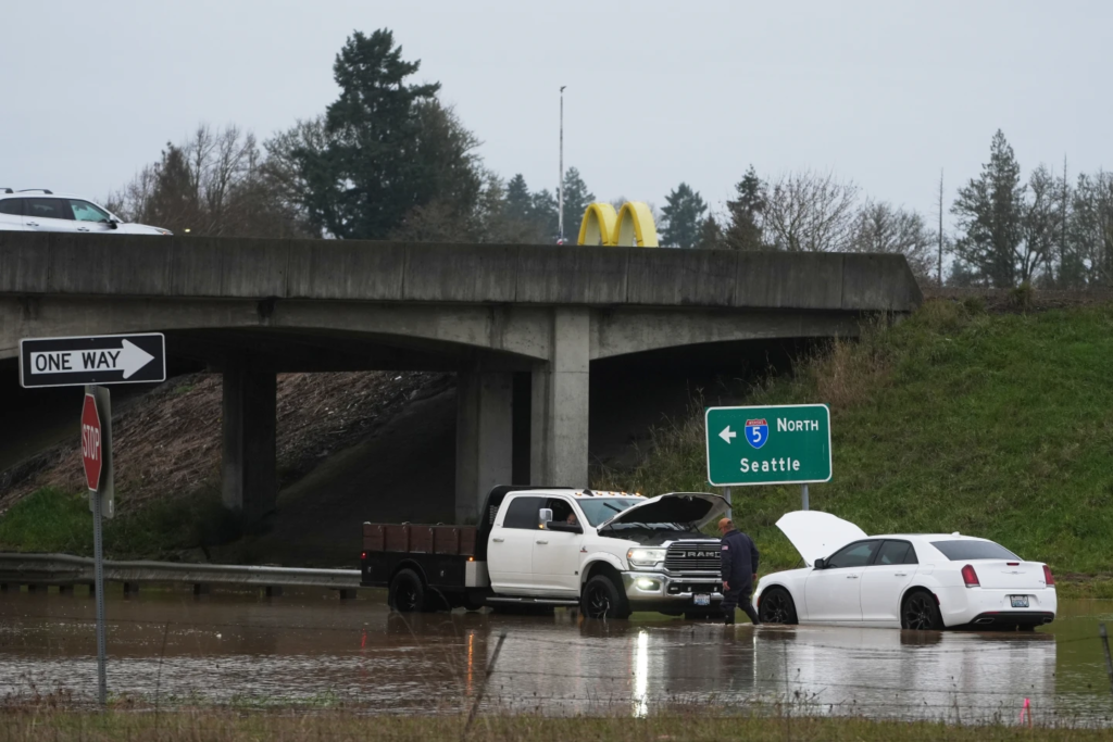
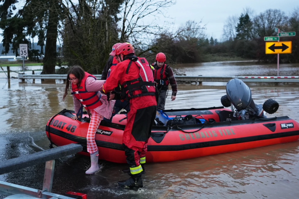
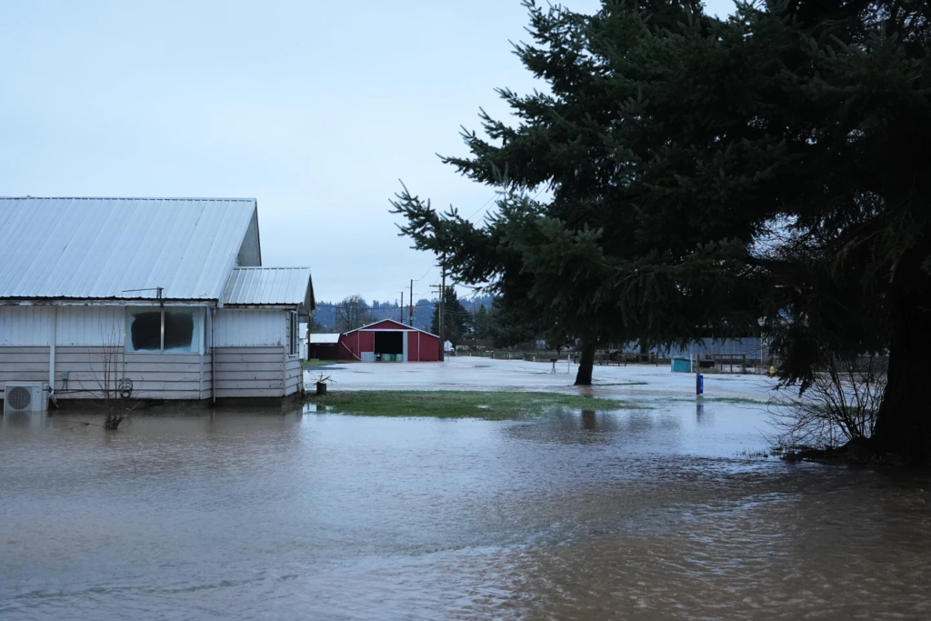
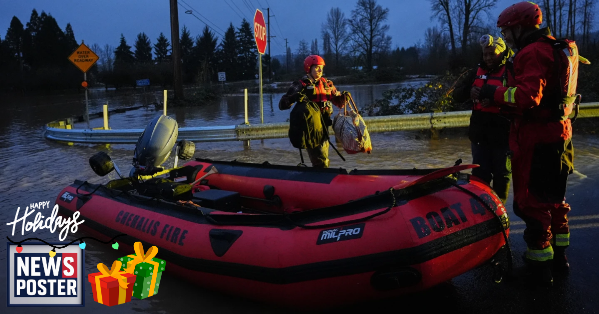
The storm, the first in what meteorologists expect to be a series this week, led to power outages, flooding, and school closures across parts of Oregon and Washington on Tuesday. Roads were blocked by debris and high water, leaving some vehicles submerged. Northeast of Seattle, fire crews used inflatable kayaks to rescue stranded drivers and carried a person roughly a mile to safety after they became trapped in the woods by rising water.
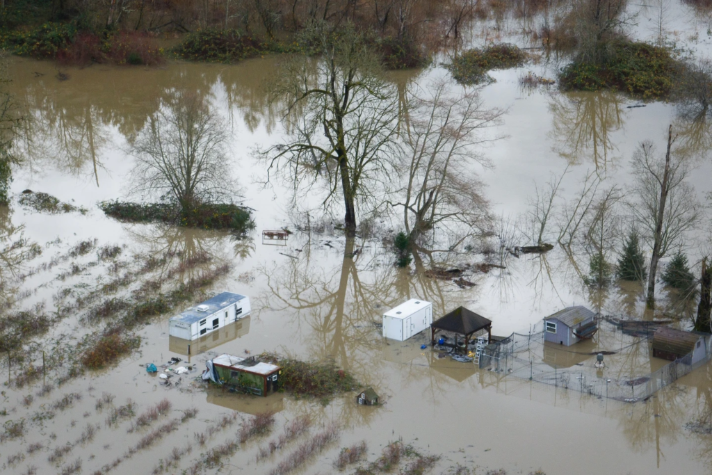
Washington Gov. Bob Ferguson said the state’s Emergency Operations Center had moved to its highest activation level due to the heavy rain and wind. Forecasters warned that rivers were still rising, with major waterways expected to peak later in the week. The Skagit River near Concrete, northeast of Seattle, was projected to exceed 15 feet above major flood levels by Thursday, potentially breaking a record.
Harrison Rademacher, a meteorologist with the National Weather Service in Seattle, described the storm system as an “atmospheric river,” a concentrated stream of moisture from the Pacific Ocean aimed directly at Oregon and Washington. The National Weather Service issued flood watches along the coast and into the Cascade Mountains, while the northern Rockies in northwestern Wyoming were expected to see more than a foot of new snow.
Along Interstate 5 between Seattle and Portland, firefighters rescued drivers attempting to navigate flooded roads, including a semitruck operator. Authorities also evacuated a family of six in Chehalis after their home became surrounded by roughly four feet of water. Deputies went door to door in some neighborhoods to warn residents, and a mobile home park along the Snohomish River was evacuated. Snohomish declared a local emergency, and Auburn installed temporary flood barriers along the White River.
Further south, Longview, near the Oregon border, opened a severe weather shelter Tuesday night. Another storm system is forecast to bring rain starting Sunday, with forecasters warning that unsettled weather may persist through the holidays. Portland officials cautioned drivers about the increased risk of accidents due to flooded roads and hydroplaning.
Meanwhile, southeast Alaska faced an arctic blast, with wind chills expected as low as minus 50 degrees in Skagway and minus 15 degrees in Juneau. In the Upper Midwest, a fast-moving storm brought freezing rain, high winds, and heavy snow, prompting school closures and virtual learning. High wind warnings were issued for most of the Dakotas, with gusts up to 65 mph expected. Central and northern Minnesota, as well as northwest Wisconsin, faced heavy snow and strong winds. The storm was forecast to move into the Great Lakes region by Wednesday, with commuters advised to allow extra travel time.