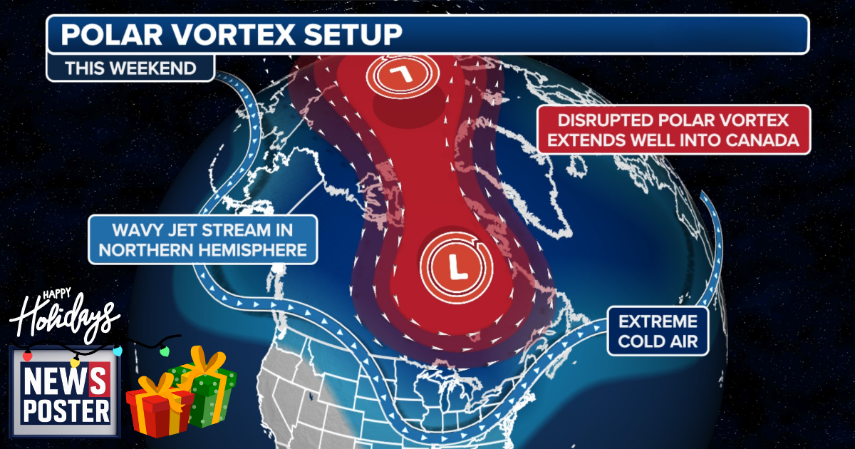
Another surge of frigid air from the Polar Vortex could move into the central and northeastern United States this weekend, raising the possibility of the first significant snowstorm of the season along the Interstate 95 corridor. Forecasters say that if this cold air combines with moisture moving across the country, conditions could be ripe for snow in key metropolitan areas.
Current computer models indicate that snow may reach the Midwest by Saturday and move into the Northeast by Sunday, though uncertainty remains high regarding timing, intensity, and exact snow totals. The Polar Vortex, a persistent area of low pressure and extremely cold air near the poles, is expected to weaken later this week, allowing Arctic air to spill south into the lower levels of the atmosphere and travel from Canada into the U.S. The system moving east from the Pacific Northwest could generate snow if cold air establishes itself in the Midwest and Northeast and sufficient moisture travels up from the south. Should all conditions align, low pressure may form near the coast, boosting the potential for heavy snow across Boston, Philadelphia, New York, and surrounding areas. Snowfall could be limited if any of these factors are missing. This forecast aligns with NOAA’s long-range outlook, which predicted an active start to meteorological winter influenced by the La Niña climate pattern.