A powerful coast-to-coast storm is set to mark the start of meteorological winter, following closely on the heels of a major Thanksgiving weekend snowstorm that caused widespread travel disruptions. The system is expected to bring a variety of winter weather impacts, including snow, ice, and rain, affecting airports, highways, and communities across the nation.
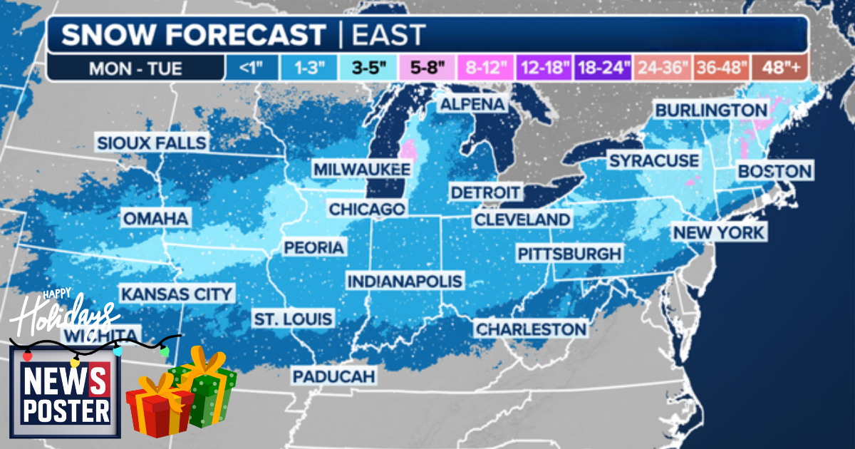
The storm will begin Sunday in the Rockies, spreading snow across parts of Utah, Colorado, and New Mexico before moving into the Plains. By Monday, the system will gain strength as it pushes into the Midwest. Cities such as Chicago, St. Louis, and Detroit could see additional snow just days after record Thanksgiving weekend accumulations. Northern Missouri and northern Illinois may receive 3–5 inches of snow, while the Ohio River Valley could see 1–3 inches. Ice is also a concern in Arkansas and Oklahoma, with cities including Tulsa, Little Rock, and Fort Smith at risk for patchy snow and potential travel disruptions.
From Tuesday through Wednesday, the storm is expected to impact the Mid-Atlantic and Northeast. Rain will dominate, with a wintry mix likely in parts of the region. Ice is possible in the mountains of West Virginia and Virginia, while inland areas of Maine and Pennsylvania could see snow as colder air moves in. Snow accumulations remain uncertain and will become clearer as the storm progresses. Meteorologists note that the storm’s precise track will be critical in determining which areas receive snow, rain, or ice.