
NEW YORK – After a week of northern clippers, accumulating snow in the Northern Tier, and a persistent Polar Vortex, winter weather is shifting toward a new region this weekend, adding to an already active La Niña season. The I-95 corridor, stretching from Washington, D.C., to Boston, is expected to see its first measurable snowfall of the season.
The storm system, currently moving through Montana, has already dropped nearly a foot of snow in parts of the Plains and Midwest, including Billings. As it progresses eastward, snow will reach the Midwest on Saturday, with cities such as Indianapolis and Cincinnati experiencing flurries throughout the day before tapering off in the evening. Kentucky Governor Andy Beshear urged residents to take precautions against the cold.
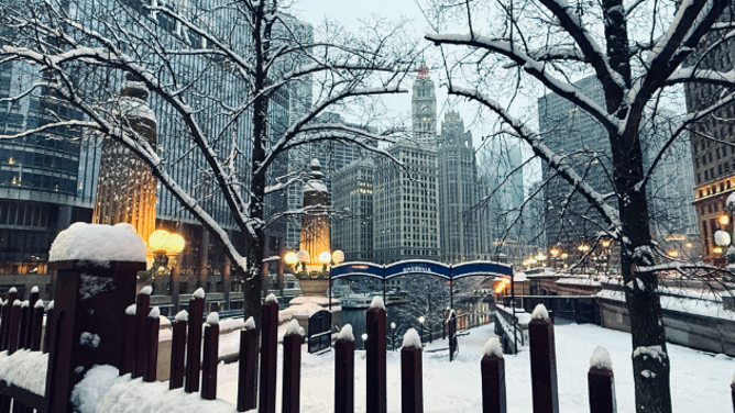
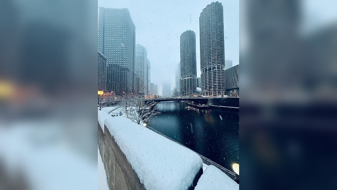
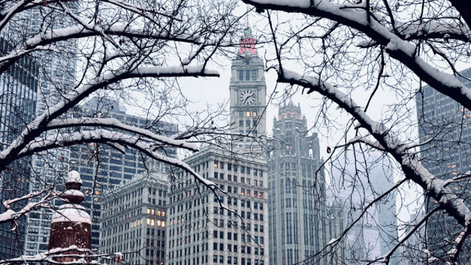
By early Sunday, the winter storm is forecast to reach the Northeast, lingering until midday before moving out. Winter Weather Advisories are in effect from Maryland to Cape Cod. Snow accumulations along the I-95 corridor are expected to range from 1–3 inches, with some areas of South Jersey and eastern Long Island seeing 4–5 inches. While not a major storm, this will mark the season’s first measurable snowfall.
Washington, D.C., Mayor Muriel Bowser warned residents to exercise caution as snow and cold settle in. New York City has activated its Winter Weather Emergency Plan, with the Sanitation Department issuing a Snow Alert for Saturday evening. Crews will pre-treat streets and deploy plows and salt spreaders as snow begins to accumulate. Residents are advised to limit travel unless necessary.
New Jersey Governor Phil Murphy also cautioned drivers and residents about the combination of snow and extreme cold across the state. In Southern New England, drier air may limit snowfall totals south of Interstate 90, but 1–2 inches are still expected, with higher amounts near the southern coast. Snow will taper off by Sunday afternoon, though ocean-effect snow may linger across Cape Cod and the islands.
Kentucky, we're facing some dangerously cold weather this weekend with windchills expected to drop to zero or below. We need folks to take this weather seriously, stay alert, and take precautions as needed. Warming centers are being set up across the state. 1/2
— Governor Andy Beshear (@GovAndyBeshear) December 12, 2025
We're expecting snow and extreme cold this weekend.
— Mayor Muriel Bowser (@MayorBowser) December 12, 2025
Big picture:
1. Up to 2" of snow starting Saturday evening
2. Extreme cold all day Sunday
3. Expected low of 9° into Monday
Be patient as our Snow Teams work to salt, clear, and keep our roads safe, DC!
We are anticipating extreme cold temperatures and snow across the state Saturday night into Sunday morning. 🌨️
— Governor Phil Murphy (@GovMurphy) December 12, 2025
Be cautious of snow-covered roads and stay safe, New Jersey!