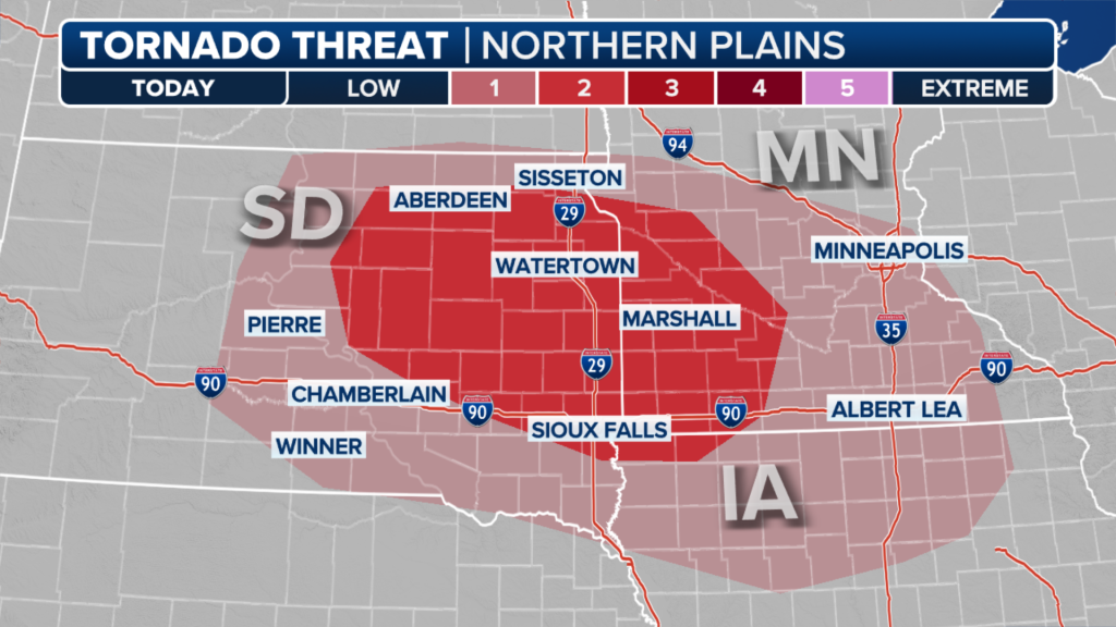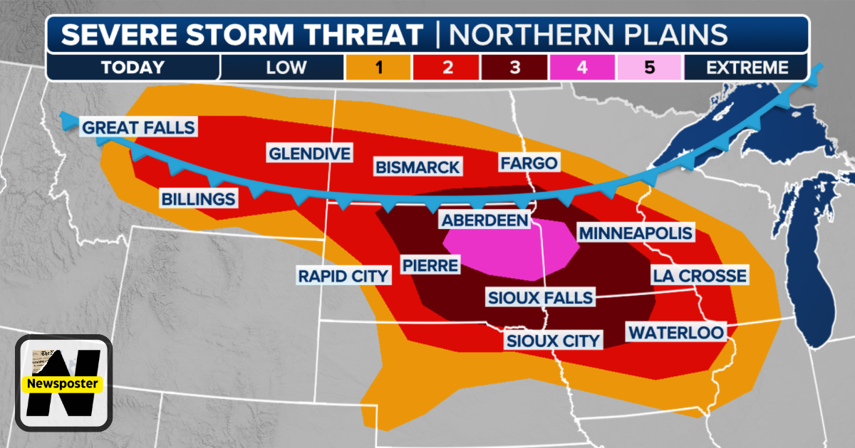
The northern Plains, including the Dakotas and Minnesota, face a renewed threat of severe weather on Monday, with violent and damaging wind gusts expected to sweep across the region. The National Oceanic and Atmospheric Administration’s (NOAA) Storm Prediction Center forecasts a derecho—a widespread, fast-moving cluster of thunderstorms—moving through parts of the northern Plains, capable of producing wind gusts exceeding 75 mph. Tornadoes and large hail are also possible alongside the damaging winds.
A derecho is characterized by a long swath of straight-line wind damage covering hundreds of miles, with multiple wind gusts of at least 75 mph tied to the same thunderstorm system. Meteorologists expect intense storms to develop over western South Dakota in the afternoon, progressing eastward through the evening and overnight. These storms are driven by a cold front moving southeast. Eastern South Dakota and parts of southwestern Minnesota, including cities like Aberdeen, Watertown, Brookings, and Marshall, are under a Level 4 out of 5 risk of severe thunderstorms, according to NOAA. Additional scattered severe storms could bring damaging winds and hail across parts of Montana. Tornadoes are increasingly likely, especially along the leading edge of the storm line, with leftover storms expected to move into Wisconsin and Illinois by Tuesday morning.